For the mobile side, we’ve built an application that users can draw some lines with the width information.
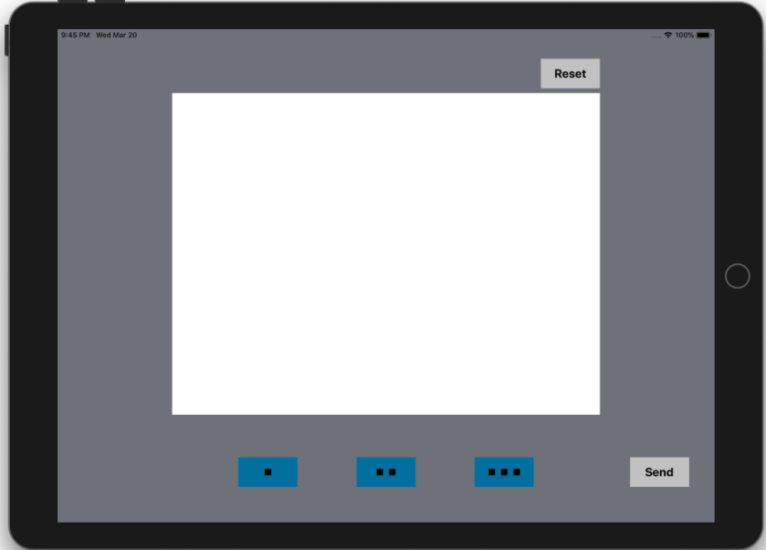
The white square at the center of this application is the drawing area which can get users’ input. Some black lines will be drawn along with the input. The blue buttons on the bottom are for the thickness of lines so that the users can simply select the desired one. We added a reset button in the case of redrawing.

The ‘Send’ button at the below is to send trajectory information to a physical robot. The data is about the relative coordinates with a starting point rather than the absolute coordinates. The drawing information would be saved by JSON type, as shown in the example below.
{'item_number' : 3,
 'infos': {
  {
   'starting_point' : [149.0,30.8],
   'thickness' : 1
   'coordinates' : [[A,B], [C,D], [E,F], ...]
  },
  {
   'starting_point' : [167.0,20.3],
   'thickness' : 2
   'coordinates' : [[A',B'], [C',D'], [E',F'], ...]
  },
  {
   'starting_point' : [195.0,16.2],
   'thickness' : 3
   'coordinates' : [[A'',B''], [C'',D''], [E'',F''], ...]
  }
 }
}
Depending on the receiver point, data structure and each item can be changed.
